Search
Close this search box.

NJ ADAPT

Data-visualization and mapping tools

NJ ADAPT is a suite of data-visualization and mapping tools developed by Rutgers University. The NJ ADAPT tools are designed to assist planners, community leaders, businesses, and residents to understand and adapt to the impacts of climate change on people, assets, and communities in New Jersey. Click on the buttons below to select the tool you would like to use.

Climate Dashboard

New Jersey climate trends in moderate and high emissions scenarios

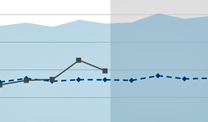
The Dashboard visualizes climate change trends and statistics for the whole of New Jersey. It compares today’s conditions to future projections and can be displayed as maps or interactive charts. Projections are summarized in seasonal intervals (winter, spring, summer, fall) for six climate measurements in moderate (consistent with today’s global policies) and high (continued growth of emissions by 2100) emissions scenarios.

Climate Planning Tool

A guide to using coastal flooding data in climate change planning

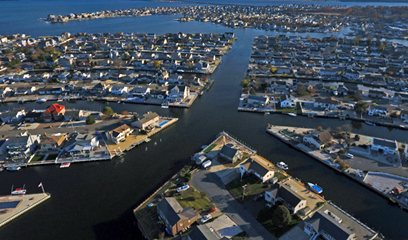
This tool assists state and local officials, communities, hazard planners, and others to understand the impacts of climate change on coastal flooding in New Jersey. Backed by data on sea level rise, hurricanes, and tidal floods, the tool explains how to use data to analyze different flooding scenarios. The tool is presented in two storymaps: the first is a primer on flooding; the second is a step-by-step outline of a coastal flood vulnerability analysis.

Climate Snapshots

Climate risks summarized by municipality, county and statewide

Adapting to climate change requires an understanding of potential hazards and exposure. These Climate Snapshots provide easy access to information about the people, places, and assets at risk from climate impacts in each of New Jersey’s municipalities, counties, and the state as a whole. Snapshots include reports on built infrastructure, critical assets, natural and working lands, public health, vulnerable populations, and forestry.

Local Planning Navigator

A decision-support tool for building community resilience

The Navigator provides end users with New Jersey specific data to better understand climate-related hazards in their localities. The Navigator enables users to assess climate-related hazards as required or recommended by various state and federal programs and can be specifically used to complete certain elements of a Climate Change Related Hazard Vulnerability Assessment as required by New Jersey’s Municipal Land Use Law.

NJ FloodMapper

An interactive flood exposure data mapping tool

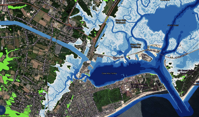
NJ FloodMapper is an interactive mapping tool that allows users to conduct flood exposure analysis based on the best available science for sea-level rise and numerous other parameters, including total water levels, hurricane surge, FEMA flood zones, and Hurricane Sandy surge. Additional map layers depict infrastructure, environmental hazards, marsh and open space, social vulnerability, flood insurance payments for property loss, and land use.

NJ Forest Adapt​

A data mapping tool for forest management

This mapping tool enables users to visualize data over multiple timelines and climate change scenarios. Users can explore changes in plant hardiness and heat zones, species distribution, daily minimum and maximum temperatures, heating and cooling degree days, and precipitation. Additional map layers include forest carbon density, canopy cover, impervious surfaces, forest types, pest and disease, wildfire fuel hazard, and more.

NJ HazAdapt

Data and resources for hazard mitigation planning

Developed with the NJ Office of Emergency Management, this tool provides municipal and county hazard planners with easy access to data and resources that will assist with development of hazard mitigation plans. State and local users can assess flooding impacts on key FEMA lifeline sectors, socially vulnerable populations, and individual land parcels. The tool includes heat hazard data to understand the impacts of heat waves and the urban heat island effect.

NJ Public Health Adapt

Climate planning for improved health outcomes

NJ Public Health Adapt was developed to support efforts at the state, regional and local levels to understand the impacts that changing climate conditions may have on public health as well as to support efforts to adapt to changing climate conditions in ways that improve health outcomes, especially for those populations experiencing climate-related health disparities. Intended users include healthcare professionals, public health agencies, municipal and county planners, and NGOs.

NJ ResTOrS

New Jersey Restoration Tool Organization Suite (NJResTOrS)

Developed by a coalition of state agency, non-governmental organization and academic partners, NJResTOrS is one component of a larger strategy to equip coastal municipal planners and non-profit partners with the resources to plan and coordinate coastal restoration projects to advance climate change adaptation. NJResTOrS provides a more seamless integration of web-based decision-support tools so that users can work directly from issue scoping through project evaluation.

Rutgers Inland Design Flood Elevation

FEMA 1% Chance Annual Flood +3 feet

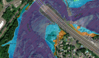
This data layer is consistent with the NJDEP Inland Flood Rule establishing a new Design Flood Elevation (DFE) standard for specific types of new construction and redevelopment. The new DFE is 3 feet above the elevation of the 1% Chance Annual Flood for New Jersey, also known as the 100-year flood (and equivalent to 2 feet above the NJDEP mapped flood elevation).

NJADAPT is a planning tool; it is not designed to render determinations as to the regulatory status of an individual property. Rutgers is constantly improving NJADAPT with new data, applications, functions, and tools. If you would like to be notified of updates to NJADAPT as well as trainings for its use, please join our mailing list. We welcome your feedback; please send us comments or examples of how you use NJADAPT.

Welcome to NJADAPT

NJADAPT is a suite of free web-based data visualization and mapping tools, developed by Rutgers University. The NJADAPT tools are designed to support efforts to connect scientific climate change data with other critical information so that citizens, community leaders, residents, state and local decision makers, businesses, and others can better understand the impacts of changing climate conditions on people, assets and communities in New Jersey. The NJADAPT tools provide end users with the data needed to undertake strategies to adapt to and build resilience and preparedness in light of climate change.

NJADAPT is a planning tool; it is not designed to render determinations as to the regulatory status of an individual property. Rutgers is constantly improving NJADAPT with new data, applications, functions, and tools. If you would like to be notified of updates to NJADAPT as well as trainings for its use, please join our mailing list. We welcome your feedback on use of the NJADAPT tools and we would like to feature stories of how New Jerseyans are using the NJADAPT tools; please offer any comments or examples of your work by contacting us through this link.

Using NJADAPT
There are many ways to use the suite of NJADAPT tools. All of the tools built into NJADAPT rely on the same consistent set of data regarding climate conditions, demographics, critical assets, the natural and built environment and other factors.

Please feel free to explore the NJADAPT tools and data. For users that have a specific purpose for using NJADAPT, there are built in applications that make it easy for you to access relevant NJDAPT data:

Meet the Climate Corps

Angel Alguera, Rutgers Climate CorpsAngel Alguera
I am a first-year Atmospheric Science master’s degree student in the Department of Environmental Sciences, and my work focuses on meteorology and applications of climate change resiliency. My professional interests include severe weather forecasting and community preparedness regarding weather-related disasters. I work with Dr. James Shope at the NJ Climate Change Resource Center to produce applied research and reports relevant to New Jersey stakeholders. I currently assist with climate change data analysis, large dataset management, and report writing.

Daniel GilkesonDaniel Gilkeson
I’m a second-year master’s student in the City and Regional Planning Program with a concentration in environmental planning. As a planner, I hope to build more resilient communities in the face of increased risk due to climate change. With the Climate Change Resource Center, I am working on a project to aid the state in an update of its floodplain buyout program, known as Blue Acres, to be more proactive and comprehensive. Prior to this position, I interned in the Community and Economic Development Office at the Delaware Valley Regional Planning Association. I’m also an AmeriCorps alum, having completed a year of service working on affordable housing in Nashville, Tennessee.

Benjamin GoldbergBenjamin Goldberg
I am a second-year Master of City and Regional Planning student concentrating in climate adaptation and resiliency planning, with experience in sustainable food systems. I joined the Climate Corps last summer to help develop a GIS-based food waste recovery tool, and currently support community resilience through flood vulnerability analysis. I hold a B.A. from Middlebury College and a Certificate in Ecological Horticulture from UC Santa Cruz.

Surya Jacob, Rutgers Climate CorpsSurya Jacob
I am a graduate student in the Master of City and Regional Planning program at the Bloustein School concentrating in community development, focused on housing, land and finance, as well as pursuing the Real Estate Development/Redevelopment Certification. Prior to Bloustein, I worked as an architect and interior designer in India and Canada and am pivoting towards a career in urban planning to engage in extensive projects at the macro level. My interests include affordable and mixed income housing, urban redevelopment, and housing finance, and I am deeply passionate about climate resilience in community planning. Being part of Climate Corps is a foundational step towards helping to solve equity issues in vulnerable communities along the coastal region.

Vineesh Das Kodakkandathil, RutgersVineesh Das Kodakkandathil
I am an urban planner with five years of professional experience in community-led ecotourism development and land use and environment management planning in ecologically sensitive areas. I have worked on and conducted extensive environmental sensitivity analyses, flood and landslide vulnerability assessments, and human impact assessments with the help of GIS tools. I’m currently pursuing my master’s in City and Regional Planning at Bloustein School with a concentration in Transport Planning and GIS.

Douglas LeungDouglas Leung
I am working with the Climate Change Resource Center to identify vulnerable communities and places affected by climate-induced flooding in coastal New Jersey municipalities. I am a Master of City and Regional Planning candidate at the Edward J. Bloustein School of Planning and Public Policy at Rutgers University. As a planner, I want to develop strategies and solve problems affecting our cities and communities that enable more equitable outcomes in housing and transportation. I am also a recent Army veteran, having served as a company commander of recruiting in the northern suburbs of Chicago and as a reconnaissance platoon leader in the 10th Mountain Division. For fun, I enjoy weightlifting, running, reading fiction, and board games.

Nihar MhatreNihar Mhatre
I am a master’s candidate in city and regional planning at Rutgers University’s Edward J. Bloustein School of Planning and Public Policy, focusing on urban design and land use planning. Before being accepted at Rutgers, I worked as an architect at JD Studio and had my own architectural practice, Vastu Insights. My research interests revolve around designing and developing climate change adaptation and resilience strategies to promote equity in urban landscapes. Having the opportunity to work on real-world projects through Climate Corps will be an essential step in the development of my understanding of addressing climate change issues in vulnerable regions.

Justin MorrisJustin Morris
Justin is a master’s student at Rutgers University studying discovery informatics and data sciences. He is working under Professor Mark Rodgers to develop an optimization model that will act as a decision support tool for university financial investments with the end goal of eliminating Rutgers’ scope 2 emissions. He is excited to apply his background in data analytics and mathematical programming to help the university fight climate change.

Josephine O'GradyJosephine O’Grady
I am a first-year student in the Master of Public Policy program. Through the Coastal Climate Risk and Resilience (C2R2) certification, I am focusing a significant portion of my graduate coursework on topics including coastal geomorphology, environmental justice, and hazard mitigation planning. Before beginning my studies at the Bloustein School, I received my bachelor’s degree in public health from Kean University, where I first became interested in how coastal dynamics shape lived experiences. I previously served as an intern at the New Jersey State Policy Lab and currently work for the Megalopolitan Coastal Transformation Hub (MACH) team.

Jessica Parineet Jessica Parineet
I am a first-year Master of Public Policy student at the Bloustein School with a strong interest in climate change policy and related topics. In my previous work, I gained experience in a number of dimensions of climate change issues through carbon capture storage research, urban heat island research, and community level engagement as I am currently on the Student Advisory Board for the Rutgers Office of Climate Action. I am excited to expand on my interests in environmental justice and local level resilience planning through my involvement in the Climate Corps.

Dillon Patel Dillan Patel
I am a second-year Master of City and Regional Planning student concentrating in Environmental Planning and International Development. I have previously worked as an economist performing cost-benefit analysis and conducting monitoring and evaluation for renewable energy in developing countries. I have also spent a summer in western Massachusetts mapping stormwater infrastructure and working with planners to identify suitable places for green stormwater infrastructure.

Moira Sweeder, Rutgers Climate CorpsMoira Sweeder
I am a graduate student enrolled in the Master of City and Regional Planning program at the Bloustein School. My concentration is environmental planning with a focus on coastal resilience. Before pursuing my master’s degree at Rutgers, I studied sustainability at Stockton University. During this time, I interned for the PSEG Institute of Sustainability Studies, the Jacques Cousteau National Estuary Research Reserve, and NJ Audubon. I am thrilled to now be a part of the Climate Corps, researching coastal resilience as a part of the Megalopolitan Coastal Transformation Hub (MACH) team.

Thanks. Your submission was sent successfully.