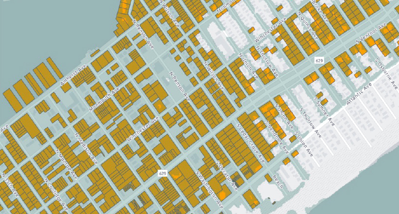
Current and Future Flood Exposure to New Jersey Properties and Associated Assessed Property Value at Risk
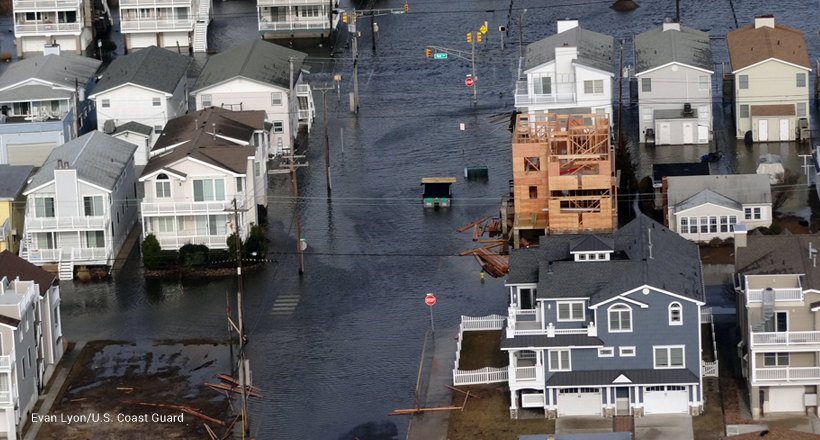
People and property are at risk from current and future flood related hazards in New Jersey. This report uses the state MOD-IV property tax assessment and parcel dataset to analyze the acreage of land parcels and the economic value of the structures potentially at risk from current and future flood scenarios in New Jersey. All flood scenarios show a disproportionate potential impact to residential properties compared to other property classes. A considerable number of properties and structures currently reside in the FEMA 1% and 0.2% flood hazard areas and at risk from flooding events already occurring in the state and at increasing frequency and intensity. While there are relatively smaller impacts in the coastal area due to regularly occurring nuisance flooding, sea-level rise estimates for the upper end of the likely range project up to 2.1 feet of sea-level rise could occur by 2050 and thus properties or structures could be fully or partially inundated by then, resulting in permanent disruption to these areas. Projecting out to 2100, the same models estimate up to 5 feet of sea-level rise which is shown to have much greater impact to coastal areas of the state, resulting in the potential permanent loss of properties and structures that could have substantial impacts to these communities.
Current and Future Flood
Exposure to New Jersey
Properties and Associated
Assessed Property
Value at Risk